Trail Snowshoes Le Monêtier-les-Bains - Le Casset - Photo
 aja
aja

User

© OpenStreetMap contributors
Length
Length
8.1 km
Max alt
Max alt
1551 m
Uphill gradient
Uphill gradient
119 m
Km-Effort
Km-Effort  
9.6 km
Min alt
Min alt
1466 m
Downhill gradient
Downhill gradient
119 m
Boucle
Boucle
Yes
Creation date :
2015-02-08 00:00:00.0
Updated on :
2015-02-08 00:00:00.0

(0 Reviews)

Snowshoes
Snowshoes
2h30
Difficulty : Easy

Scan this QR Code to open this trail in the SityTrail application

FREE GPS app for hiking

Logo SityTrail SityTrail

IGN / Geographical institutes

Download SityTrail from the App Store Download SityTrail from Google Play

Logo SityTrail SityTrail World

The world is yours!

Download SityTrail from the App Store Download SityTrail from Google Play Download SityTrail on Huawei AppGallery

About

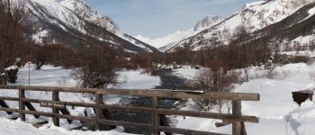
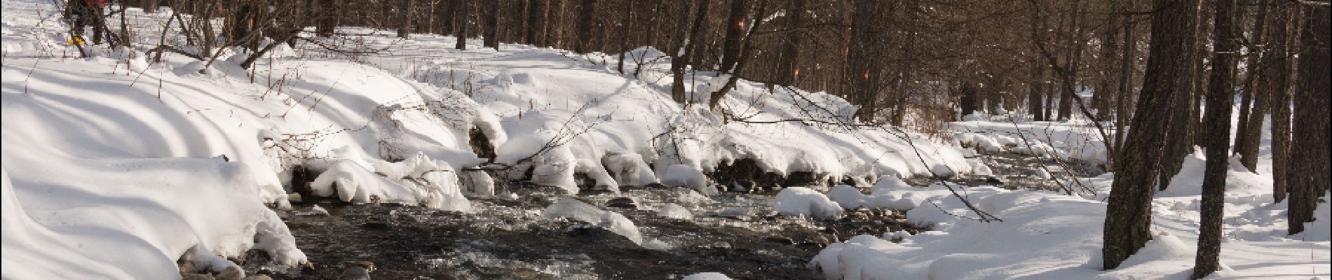
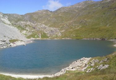
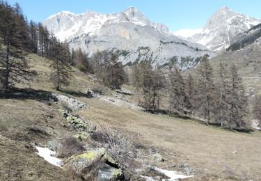
Trail Snowshoes of 8.1 km to be discovered at Provence-Alpes-Côte d'Azur, Hautes-Alpes, Le Monêtier-les-Bains. This trail is proposed by aja.

Description

Agréable balade de mise en jambe sans dénivelé, permettant de côtoyer la Guisane et le beau bois de mélèzes du Casset

Elevation profile

Photos

Points of interest

Point of interest Le Monêtier-les-Bains - Pont des Granges - Photo
aja
LE MONÊTIER-LES-BAINS 
Point of interest Le Monêtier-les-Bains - Les Bains - Photo
aja
LE MONÊTIER-LES-BAINS 
Point of interest Le Monêtier-les-Bains - Ruisseau - Photo
aja
LE MONÊTIER-LES-BAINS 

Positioning

Country:
France
Region :
Provence-Alpes-Côte d'Azur
Department/Province :
Hautes-Alpes
Municipality :
Le Monêtier-les-Bains
Location:
Unknown
Start:(UTM)
303888 ; 4983295 (32T) N.

Trails nearby

Trail Walking Le Monêtier-les-Bains - Le Grand Lac - Photo
Walking
tracegps

Walking

Difficult
(2)
Le Monêtier-les-Bains, Provence-Alpes-Côte d'Azur, Hautes-Alpes, France
5.2 km | 12.8 km-effort
5h 0min
No
Trail Walking Le Monêtier-les-Bains - pic est de Combeynot - Photo
Walking
GUIDE
amiral13

Walking

Very difficult
Le Monêtier-les-Bains, Provence-Alpes-Côte d'Azur, Hautes-Alpes, France
13.3 km | 33 km-effort
6h 24min
Yes
Trail Walking Le Monêtier-les-Bains - l'aiguillette du Lauzet par le grand lac - Photo
Walking
GUIDE
amiral13

Walking

Difficult
Le Monêtier-les-Bains, Provence-Alpes-Côte d'Azur, Hautes-Alpes, France
13.8 km | 29 km-effort
8h 39min
Yes
Trail Walking Le Monêtier-les-Bains - Chalet de l'Alpe - Grand lac - Croix 15/08/18 - Photo
Walking
GUIDE
R@ph

Walking

Medium
Le Monêtier-les-Bains, Provence-Alpes-Côte d'Azur, Hautes-Alpes, France
11.7 km | 22 km-effort
4h 23min
Yes
Trail Via ferrata Le Monêtier-les-Bains - Via ferrata Aiguillette du Lauzet 30/06/18 - Photo
Via ferrata
GUIDE
R@ph

Via ferrata

Medium
Le Monêtier-les-Bains, Provence-Alpes-Côte d'Azur, Hautes-Alpes, France
9.5 km | 21 km-effort
2h 30min
Yes
Trail Walking Le Monêtier-les-Bains - Haut tour des Cerces - Photo
Walking
druilhe

Walking

Very difficult
(1)
Le Monêtier-les-Bains, Provence-Alpes-Côte d'Azur, Hautes-Alpes, France
42 km | 77 km-effort
15h 27min
Yes
Trail Walking Le Monêtier-les-Bains - Le grand lac - Photo
Walking
GUIDE
amiral13

Walking

Medium
Le Monêtier-les-Bains, Provence-Alpes-Côte d'Azur, Hautes-Alpes, France
10.7 km | 20 km-effort
6h 15min
Yes
Trail Walking Le Monêtier-les-Bains - Lac du Glacier d'Arsine - Photo
Walking
patsure

Walking

Difficult
(1)
Le Monêtier-les-Bains, Provence-Alpes-Côte d'Azur, Hautes-Alpes, France
16.3 km | 29 km-effort
Unknown
Yes
Trail Touring skiing Le Monêtier-les-Bains - La pointe de L'etandard - Photo
Touring skiing
nadd73

Touring skiing

Medium
Le Monêtier-les-Bains, Provence-Alpes-Côte d'Azur, Hautes-Alpes, France
9.4 km | 27 km-effort
4h 3min
Yes


Close
My subscriptions